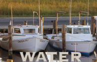
Bountiful Harvest – Working the Water:
|
|
 Imagine…Striped bass, American and hickory shad, largemouth bass, blue gills, perch, bluefish, flounder, Atlantic croaker, spot, and many other species! Crab for fun and for dinner! Chesapeake Country offers some of the most diverse and exciting fishing in the region. There are over 5,000 square miles of prime fishing in the Chesapeake Bay, tidal tributaries, and lakes. Recreational anglers can find fishing spots from shorelines, piers, and boats year round. You will see Imagine…Striped bass, American and hickory shad, largemouth bass, blue gills, perch, bluefish, flounder, Atlantic croaker, spot, and many other species! Crab for fun and for dinner! Chesapeake Country offers some of the most diverse and exciting fishing in the region. There are over 5,000 square miles of prime fishing in the Chesapeake Bay, tidal tributaries, and lakes. Recreational anglers can find fishing spots from shorelines, piers, and boats year round. You will see
numerous recreational boats, but a closer look will give you a bird’s eye view of the working boats of the Chesapeake and the harvest locals and visitors alike delight in consuming!
Pick up the “Fish Maryland” Map and Guide at any visitor’s center for more details on finding water access and great fishing spots to try while you’re here! If water is your thing, this is the itinerary for you!
This itinerary takes at least an extended weekend. Depending on your affinity for water, feel free to stay longer and enjoy the bounty of the bay! Pack your fishing gear, waders, canoe, kayak, and don’t forget your sunscreen. Abundant opportunities for leisure, sport, culture, and stewardship exist in Chesapeake Country. This itinerary is just a sampling of what the region has to offer.
Byway Etiquette
The Chesapeake Bay is a living estuary. The bay influences the entire region, and vice versa. We encourage visitors to practice “Low Impact Tourism” by using Chesapeake Country’s cultural and natural resources wisely, to enhance our local economies, and insure the preservation of the quality of life both visitors and residents treasure!.
Recreational boaters should respect watermen and commercial vessels. Remember that the Chesapeake Bay and the C&D canal are major commercial waterways. Commercial boats have the right of way over all recreational boats including sailboats. Understand whistle signals – five short blasts on the whistle is the “danger” signal. Designate a lookout, one person to watch for commercial traffic. Respect those whose livelihoods depend on our waterways.
Licenses may be required for some of the ‘working the water’ activities. License information can be found at http://dnr2.maryland.gov/Pages/licensing.aspx. Recreational crabbing and fishing information for tidal and non-tidal waters can be found at http://dnr2.maryland.gov/fisheries/Pages/regulations/index.aspx.
Chesapeake & Delaware Canal, Route 213 South,
Chesapeake City, MD
What better way to begin your Chesapeake Country Working the Water tour than in Chesapeake City, Maryland, our northern gateway to the scenic byway! The canal is a true example of “Working the Water” as 40% of all cargo visiting the Port of Baltimore use the canal to shorten their trip. Vessels would otherwise have to go around the Delmarva Peninsula to the mouth of the Chesapeake Bay and up to Baltimore. The canal is unique as the sole major commercial navigation waterway in the United States built during the early 1800s still in use and is itself on the National Register of Historic Places. Though your eyes may deceive you, those vessels really do fit under the canal bridge! Look for the vessel flag to see which country it originated from. The US flag will also be flying because vessels engaged in foreign trade are required to have a U.S. Coast Guard certified pilot. As the vessel approaches Chesapeake City, a tugboat will hug the side of the vessel and without stopping, the pilots use the Jacob’s Ladder or ship’s gangway to board vessel and guide the vessel through the canal.
Visit the Chesapeake & Delaware Canal Museum, which is open Monday through Friday 8 AM to 4:30 PM. The museum is a history of the building of the canal and is housed in the original canal pump house. Visit their website to learn more about the history of the canal. http://www.nap.usace.army.mil/Missions/CivilWorks/ChesapeakeDelawareCanal/CanalHistory.aspx
While in Chesapeake City, join one of the Miss Clare Tours as Captain Ralph Hazel,
a direct descendant of a mid-19th century steam boat captain, talks about the distinct culture of Chesapeake City, "...the city a canal built." Experience this fascinating historic excursion by water of the Chesapeake and Delaware Canal and the Upper Chesapeake Bay. The M/V Miss Clare is an authentic Chesapeake Bay "deadrise." Built in Cambridge, Maryland in 1979, the Miss Clare was a charter sports-fishing vessel in the Atlantic Ocean for seven years. It is certified by the United States Coast Guard to carry 27 passengers for hire. http://www.missclarecruises.com/
It is easy to spend the day (or more!) in Chesapeake City. Be sure to try some local fare at any of the fine eateries in town! Visit www.chesapeakecity.com or www.seececil.org to learn more!
Suggested time spent: ½ to a full day.
Continue on Route 213 South to Fredericktown/Georgetown.
Georgetown Boat Ramp
(or pick one of Kent County’s 30 public boat launch ramps!)
Anglers wanting to spend a day on the waters may want to launch their boat from the public boat ramp found here. Here at the Sassafras River, catfish and largemouth bass are common. Non-residential or Three-day trailer permits are required. To view all the public landings for Kent County and to see where you can purchase a permit, visit: http://www.kentcounty.com/gov/pubworks/landings.htm.
If you didn’t eat lunch in Chesapeake City, or you want to extend your stay, stop in The Historic Kitty Knight House. Local diners can be found a couple miles south in Galena. Kent County hosts a Youth Fishing Derby every June. Visit www.kentcounty.com for more information.
Suggested time spent: ½ day if fishing.
Mileage: 14 miles
Estimated drive time: 23 minutes
Continue South on Route 213. Turn Right onto Route 298, then right onto 292 to the beach.
Betterton Beach:
This beach is a county recreational area for swimming, boating, fishing, and picnicking. Located at the mouth of the Sassafras River, fresh-water currents lower the salinity of the upper Chesapeake, keeping away sea-nettles that generally plague Bay swimmers. Betterton emerged in the 1700’s as a small fishing village. It grew into a flourishing 19th century trade center due to its proximity across the bay from the port of Baltimore, and with its deep water landing, became a point of call for boats bringing cargo in exchange for Kent County’s agricultural exports. In its 1800’s heyday, Betterton became a vacation destination as “Maryland’s Foremost Bay-side Resort”, consisting of boardwalks, hotels, restaurants, dance halls, bowling alleys, beer gardens, concessions, and amusement arcades. Now, this 5 acre landscaped, family oriented waterfront park is the largest of two public beaches in the county on the Chesapeake Bay. The exceptional sandy beach has 300 feet of frontage for swimming and 700 feet of shoreline access. It is equipped with a bathhouse with public restrooms and 500 feet of boardwalk, with benches, lighting, and handicap access. A picnic pavilion is located on a bayview bluff. There is a fishing jetty with a surface walk, a public pier, and improved parking areas. Boating is available from a public landing and pier.
Suggested time spent: ½ day – 1 day
Mileage: 15 miles
Estimated drive time: 26 minutes
From Betterton, head to Rock Hall. Return to Route 213 via Route 292, or remain on Route 298 to Route 20 West.
Rock Hall, ‘Pearl of the Chesapeake’
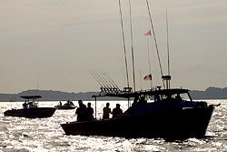
Whether you’re in the mood to charter a boat, eat fresh seafood, sit on a bay beach, or do some more fishing, Rock Hall is the place to be! Known as the “Pearl of the Chesapeake”, Rock Hall is a quaint fishing town where for generations, families have made their living as watermen. By nautical miles, Rock Hall is 14 NM from Annapolis and 18 NM from Baltimore’s inner harbor. Rock Hall is a great place to charter a boat for the day. An extensive fleet of charter boats allows you to participate in the ritual of catching your own dinner! Sail and power boats are also available if you want to just cruise the open waters of the bay!
Your ‘Working the Water’ tour would not be complete without a visit to the Watermen’s Museum, located at Haven Harbour Marina. The museum is a tribute to Maryland’s watermen and exhibits artifacts on oystering, crabbing, and fishing. A reproduction shanty house is on display, along with historical photos, local carvings, and of course, boats. Come learn about skipjacks, deadrises, and the other working boats of the Chesapeake.
If you’ve brought your own boat, Bayside Landing is a popular public boat launch ramp, which has a pool and other public facilities as well as a bulkhead where the commercial watermen unload their daily catches (except in a south wind!) Rock Hall hosts a Rockfish Tournament every June. Visit www.rockhallmd.com or www.kentcounty.com for more information.
Suggested time spent: ½ day
Mileage: 22 miles
Estimated drive time: 35 minutes
From Rock Hall, head south on Route 445 to Eastern Neck National Wildlife Refuge.
Try your hand at soft crabbing! Eastern Neck Island.
If you’ve never been soft-crabbing, Eastern Neck Island is the place to try! If you don’t know what a soft-crab is, visit: http://www.blue-crab.org/crabbing/softcrabs.html. Launch a boat or an inflatable raft and try your hand a scapping! This is the man against crab mode of crabbing and is used for both hard and soft-shelled crabs. Scapping uses a dip net to catch crabs, or you can use a line and a chicken neck for bait! Remember, hard shell crabs must be 5 inches tip to tip and soft shell crabs must be 3.5 inches to be of legal size, otherwise, return them to the water!. Bring a picnic lunch and enjoy the nature trails and scenic vistas from this treasured refuge!
Suggested time spent: ½ day
Mileage: 5 miles
Estimated Drive Time: 10 minutes
From Eastern Neck NWR, return to Chestertown and drive to the end of High Street. Park your car and walk to the Schooner Sultana dock down by the Old Wharf Restaurant.
Ride the Schooner Sultana, ‘Schoolship of the Chesapeake’.
History and water buffs alike will enjoy a 2-hour sail on the Chester River aboard this 1768 replica, the Schooner Sultana. Public sails are available by reservation throughout the sailing season, late May through early November. This educational schooner may not always be at its home dock as it makes its way around the region serving as a sailing classroom teaching about both history and the environment. Visit www.sultanaprojects.org to view the public sails schedule of events and for more information.
Suggested time spent: 2 hour sail
Mileage: 16 miles
Estimated Drive Time: 25 minutes
From Chestertown, head South on Route 213 to Centreville. Turn Right onto Broadway, to Chesterfield, to Front Street.
Centreville Landing: (or any of Queen Anne’s nine other landings)
Launch your boat or go kayaking on the Corsica River! This one - acre facility has a 26 - foot wide boat launching ramp and parking for about 15 vehicles. There are 22 boat slips, which are offered for rent annually in May. Fishing and crabbing are accessible from this location on the Corsica River and permanent restrooms are available for patrons April through November. Hours: 24/7 Pets: Not allowed; Fee: Daily or Annual Public Landings Permit is required for parking. * All public landings, piers, and marinas are trash free facilities. Please carry out what you carry in. Visit www.discoverqueenannes.com for more information.
Suggested time spent: ½ day if fishing
Mileage: 16 miles
Estimated Drive Time: 25 minutes.
Continue on Route 213 South. Turn Right onto Route 18 West. Follow the byway onto Route 301 outside of Queenstown, take your first exit off US301, and continue to follow byways signs for Route 18 West. In Grasonville, turn left onto Perry Corner Road. The entrance to Chesapeake Bay Environmental Center is located about 1/2 mile on the right, and is clearly marked with a brown and white sign. Turn right at the sign onto a dirt road called Discovery Lane. Take Discovery Lane until it ends at the Visitor Center parking lot.
Chesapeake Bay Environmental Center, WildFowl Trust of North America, Grasonville, Maryland.
Canoe the surrounding waters and wetlands at the Chesapeake Bay Environmental Center! You can also explore over 4 miles of wetland and woodland trails, collections of live waterfowl and non-releasable raptors, and an aviary and visitors center. Visit: http://www.wildfowltrust.org/index.htm for the center’s interesting and educational calendar of events and environmental camps.
Suggested time spent: 2-4 hours depending on weather and schedule of events.
Mileage: 14 miles
Estimated drive time: 25 minutes
Return to Route 18 West, and follow to Piney Narrows Road. End your “Working the Waters” tour at the Chesapeake Exploration Center.
The Chesapeake Exploration Center: Our Chesapeake Legacy, Chester, Maryland.
The Exploration Center serves as Queen Anne's County official welcome center and is the central hub for the highly acclaimed Cross Island Trail. The Center is also home to the exhibit entitled “Our Chesapeake Legacy”, an interactive, hands-on exhibit, designed to make learning about the region both fun and memorable. The exhibit provides visitors an overview of the region’s heritage, resources, and culture. It also explores man’s close relationship with the Bay and how that relationship has shaped our culture and history – and conversely – how we have shaped the environment of the Bay. The Center’s grounds are home to the “Anna McGarvey” an accurately restored skipjack, highlighting the heritage of the “State Boat”. Hours: Monday – Friday 8:30am – 4:30 pm, Saturday 10am – 4pm. Pets: Allowed on leash.
Suggested time spent: 1 hour
Mileage: 4 miles
Estimated drive time: 10 minutes.
If it’s meal time, stop into one of several seafood restaurants in the Kent Narrows/Chester area for some local fare! You can’t leave without tasting the bountiful harvest brought to you by those who work the water!
|